
Vaswani Bagalur Location
Vaswani Bagalur is planned in the Hardware Sector of the KIADB Hitech Defence and Aerospace Park at Huvinayakanahalli (also spelt Hoovinayakanahalli), near Bagalur, in Yelahanka taluk, north Bengaluru. The aerospace park is an industrial park of manufacturing, electronics, logistics and technology campuses in the airport belt, and Kempegowda International Airport is about 12 km by road from the centre of the site. The entry and exit gates are planned on the south side of the plot, facing a 45-metre-wide road within the park. All distances are routed road distances from the centre of the site, rounded; the main gate is on the southern side, so a journey from the gate can differ slightly.
Project status
Upcoming - Vaswani Group has not yet named this project, and it is not registered with K-RERA as at 7 October 2026.
On this page
Vaswani Bagalur Location in the Aerospace Park
| Item | Detail |
|---|---|
| Address | Plot AM-03, Hardware Sector, KIADB Hitech Defence and Aerospace Park, Huvinayakanahalli, Yelahanka taluk, Bengaluru, Karnataka |
| Map position | 13.1549 N, 77.6969 E, the centre of the plot |
| Setting | An industrial park of manufacturing, electronics, logistics and technology campuses |
| Entry and exit | Separate gates on the south side, facing a 45-metre-wide road within the park |
| Airport | About 12 km by road to the Terminal 1 entry |
| Metro | No station open; the nearest station site is about 11 km by road |
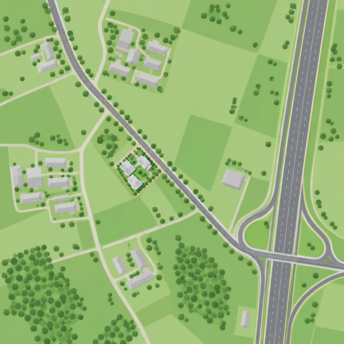
Roads and the Airport
SH 104, called Bagalur Road towards Bagalur, is met at the park gate junction about 3 km by road from the centre of the site, and Kempegowda International Airport is about 12 km by road. The drive to the airport runs north on SH 104, round the airport's western side and in by the airport's entry road; it does not use Bellary Road (NH 44). For anyone asking how far the KIADB Aerospace Park is from the airport, the figure from the centre of this site is about 12 km by road to the Terminal 1 entry.
All distances are routed road distances from the centre of the site, rounded; the main gate is on the southern side, so a journey from the gate can differ slightly.
| Place | Road km |
|---|---|
| SH 104 (called Bagalur Road towards Bagalur), park gate junction | about 3 |
| Airport trumpet flyover (NH 44 and the airport entry interchange) | about 11 |
| Kempegowda International Airport, Terminal 1 entry | about 12 |
| Bagalur Cross (NH 44 junction with Bagalur Road) | about 13 |
| Bellary Road (NH 44), nearest point near Doddajala | about 13 |
| Devanahalli town centre | about 17 |
| Yelahanka New Town centre | about 18 |
| Hennur Cross | about 19 |
| Hebbal flyover | about 25 |
| Whitefield (Phoenix Marketcity) | about 29 |
Trips towards the city depend on the destination: the Hebbal flyover is about 25 km by road, Hennur Cross about 19 km and Majestic about 30 km. Devanahalli is a town about 17 km away by road; the site lies in Yelahanka taluk, not in Devanahalli.
Metro and Rail
The Namma Metro Blue Line follows NH 44 north and turns east into the airport; it does not run along Bagalur Road. As at 7 October 2026 no station of the Namma Metro airport line (the Blue Line, Phase 2B) is open; the Hebbal to airport section is targeted for September 2027 and the whole line for March 2028, and the nearest station site, Airport City, is about 11 km by road.
The table lists Blue Line station sites, each marked under construction, with the operating Purple Line stations and the main railway stations for comparison. Dates on a line still being built are targets and can move.
All distances are routed road distances from the centre of the site, rounded; the main gate is on the southern side, so a journey from the gate can differ slightly.
| Station | Line or service | Road km | Status as at 7 October 2026 |
|---|---|---|---|
| Airport City metro station site | Blue Line (Phase 2B) | about 11 | Under construction; not open |
| Bagalur Cross metro station site (on NH 44) | Blue Line | about 13 | Under construction; not open |
| Doddajala metro station site | Blue Line | about 13 | Under construction; not open |
| KIAL Terminals metro station site | Blue Line | about 14 | Under construction; not open |
| Yelahanka metro station site | Blue Line | about 15 | Under construction; not open |
| Yelahanka Junction railway station | Indian Railways | about 16 | Check train timings for any journey |
| Jakkur Cross metro station site | Blue Line | about 19 | Under construction; not open |
| Nagawara metro station site (interchange) | Blue Line | about 20 | Under construction; not open; the interchange with the Pink Line, whose underground section is also not open |
| Krishnarajapura metro station | Purple Line | about 28 | Operating |
| Mahatma Gandhi Road metro station | Purple Line | about 28 | Operating |
| KSR Bengaluru City Junction (Majestic) | Indian Railways | about 30 | The city's main railway station |
The Purple Line stations that are operating, Krishnarajapura and Mahatma Gandhi Road, are about 28 km by road, so no Namma Metro station is open near the site today.
Work Hubs Around the Park
Aerospace, electronics, logistics and technology campuses sit within a few kilometres of the site, and the nearest on this list, the Shell Technology Centre, is about 0.5 km away by road. SAP Labs India Innovation Park is about 2.5 km away, and the Boeing and Collins Aerospace campuses are 7 to 8 km away.
All distances are routed road distances from the centre of the site, rounded; the main gate is on the southern side, so a journey from the gate can differ slightly.
| Place | Road km | Dated note |
|---|---|---|
| Shell Technology Centre | about 0.5 | Opened 2017 |
| SAP Labs India Innovation Park | about 2.5 | SAP Labs opened a second Bengaluru campus on 5 August 2025 |
| Boeing India Engineering and Technology Centre | about 7 | Opened in the aerospace park on 19 January 2024 |
| Bengaluru Aerospace Park (KIADB) | about 7.5 | The aerospace sector, where the Boeing and Collins campuses stand |
| Collins Aerospace | about 8 | Opened a manufacturing site in the aerospace park on 11 November 2025 |
| Air Cargo Village | about 10 | - |
| Manyata Tech Park | about 21 | - |
Schools and Colleges
The nearest named school, Vidyan Earth School, is about 2 km from the site by road, and Jawahar Navodaya Vidyalaya is about 4 km away; the other named schools are 8.5 to 11 km by road, and the named colleges and universities run from 8 to 17 km. Ask each institution for current admissions and transport before you plan around it.
All distances are routed road distances from the centre of the site, rounded; the main gate is on the southern side, so a journey from the gate can differ slightly.
| Institution | Type | Road km |
|---|---|---|
| Vidyan Earth School | School | about 2 |
| Jawahar Navodaya Vidyalaya | School | about 4 |
| CMR University, Lakeside campus | College or university | about 8 |
| Vidyashilp School | School | about 8.5 |
| Koshys Group of Institutions | College or university | about 9 |
| IIBS Bengaluru Airport Campus | College or university | about 9 |
| Sri Venkateshwara College of Engineering | College or university | about 10 |
| Delhi Public School Bangalore North | School | about 11 |
| Oasis International School | School | about 11 |
| REVA University | College or university | about 11 |
| Brindavan Group of Institutions | College or university | about 12 |
| Jain School of Design, Media and Creative Arts | College or university | about 14 |
| Chanakya University | College or university | about 17 |
Hospitals and Shopping
The Government Hospital, Budigere is about 7 km from the site by road; its services are not stated here, so ask what it offers. Large hospitals are 15 to 19 km away by road. The park is an industrial area, so malls are a drive away, with Bhartiya Mall about 14 km by road.
All distances are routed road distances from the centre of the site, rounded; the main gate is on the southern side, so a journey from the gate can differ slightly.
| Place | Type | Road km | Note |
|---|---|---|---|
| Government Hospital, Budigere | Hospital | about 7 | Services not stated |
| Bhartiya Mall | Mall | about 14 | - |
| Manipal Hospital North | Hospital | about 15 | - |
| NDR Multi Speciality Hospital | Hospital | about 15 | - |
| Sparsh Hospital | Hospital | about 16 | - |
| Rainbow Children's Hospital | Hospital | about 19 | - |
| HCG Hebbal | Hospital | about 19 | - |
| Phoenix Marketcity, Whitefield | Mall | about 29 | - |
Villages and Towns Around the Site
The plot lies within Huvinayakanahalli's village limits, and the village node itself is a drive away by road, about 3.5 km. Arebinnamangala, Singahalli and Bandikodigehalli lie 3 to 5 km away by road, Bagalur village is about 6 km away and Budigere about 7.5 km. The belt around these villages also carries other registered and planned apartment projects, so compare them in person as well as on paper.
All distances are routed road distances from the centre of the site, rounded; the main gate is on the southern side, so a journey from the gate can differ slightly.
| Place | Road km |
|---|---|
| Arebinnamangala | about 3 |
| Huvinayakanahalli village | about 3.5 |
| Singahalli | about 4 |
| Bandikodigehalli | about 5 |
| Bagalur village | about 6 |
| Budigere | about 7.5 |
| Sathanur | about 8 |
| Chikkajala | about 11 |
| Kannur | about 11 |
| Kogilu | about 15 |
| Thanisandra | about 18 |
Honest Trade-offs
Vaswani Bagalur's setting puts employers and the airport belt within reach by road, and a few trade-offs are worth weighing alongside that. The table sets each one down plainly, with the dated facts that go with it.
| Trade-off | What to know |
|---|---|
| Airport by road | The airport is about 12 km by road: the route runs round its western side. |
| Metro | No Namma Metro station is open near the site; the nearest station site, Airport City, is about 11 km by road. |
| Industrial setting | The site is inside an industrial park: neighbours are manufacturing, electronics and technology campuses, and the park is an industrial area, not a residential neighbourhood. |
| Daily needs | Malls are about 14 km or more by road, large hospitals 15 to 19 km, and the nearest named school about 2 km. |
| City trips | The Hebbal flyover is about 25 km by road, Hennur Cross about 19 km and Majestic about 30 km; the route depends on the destination. |
| Landfill | The Bagalur landfill lies about 3 km west of the plot in a straight line, and about 5.5 km by road. Whether it is active has not been established. The plot itself sits inside a KIADB industrial park. Visit the site at different times of day before you decide, and ask the developer what it has checked. |
| Aviation height | Building heights near an airport are regulated. No aviation height clearance has been published for this plot, and Vaswani Group has not announced a building height, as at 7 October 2026. |
| Water | Vaswani Bagalur is planned to draw on KIADB water supply, with rainwater harvesting, treated water for flushing and a sewage treatment plant on site. No supply sanction, quantity or date has been announced. The Bengaluru Water Supply and Sewerage Board's (BWSSB) jurisdiction was extended to all of Bengaluru Urban district on 24 September 2026, and no network date has been announced. |
| Forecast dates | The metro dates on this page are targets and can move. |
| Many projects nearby | Several large apartment projects are registered or planned within about 5 km by road: compare them before you commit. |
For the layout of the site itself, see Vaswani Bagalur Masterplan. For the entry prices of nearby projects, see Vaswani Bagalur Price, and for a question about the project, use the contact page.
Vaswani Bagalur Location FAQs
How far is Vaswani Bagalur from Kempegowda International Airport?
It is about 12 km by road from the centre of the site to the Terminal 1 entry. The drive runs north on SH 104 and round the airport's western side to the entrance, and it does not use Bellary Road (NH 44). No travel time is quoted here because traffic changes it. Distances are rounded and measured from the centre of the plot, not from the gate.
Is Vaswani Bagalur in Devanahalli?
No. Vaswani Bagalur is planned in Yelahanka taluk, in north Bengaluru, near Bagalur. Devanahalli is a separate town, about 17 km by road from the centre of the plot, and Kempegowda International Airport is about 12 km away by road. A locality label is a pointer and a routed distance is the measure, so compare projects by distances measured the same way.
How far is Vaswani Bagalur from Hebbal, Yelahanka and Devanahalli?
The Hebbal flyover is about 25 km away by road from the centre of the plot, Yelahanka New Town centre about 18 km and Devanahalli town centre about 17 km. Hennur Cross is about 19 km away, and Yelahanka Junction railway station about 16 km. Distances are routed road distances from the centre of the plot, rounded, so a journey from the gate on the south side can differ slightly. This site quotes no travel times, because traffic changes them.
Is there a metro near Vaswani Bagalur?
Not yet. As at 7 October 2026 no station of the Namma Metro airport line (the Blue Line, Phase 2B) is open; the Hebbal to airport section is targeted for September 2027 and the whole line for March 2028, and the nearest station site, Airport City, is about 11 km by road. The line does not run along Bagalur Road. Operating Purple Line stations, such as Krishnarajapura and Mahatma Gandhi Road, are about 28 km by road.
How far is Vaswani Bagalur from Whitefield, Majestic and the Purple Line metro?
Phoenix Marketcity in Whitefield is about 29 km away by road from the centre of the plot, and KSR Bengaluru City Junction railway station, the city's main station at Majestic, about 30 km. The Purple Line stations at Krishnarajapura and Mahatma Gandhi Road, both operating, are about 28 km away by road. All figures are routed road distances, rounded, and the route depends on the destination.
Is there a landfill near Vaswani Bagalur?
The Bagalur landfill lies about 3 km west of the plot in a straight line, and about 5.5 km by road. Whether it is active has not been established. The plot itself sits inside a KIADB industrial park. Visit the site at different times of day before you decide, and ask the developer what it has checked.
Ask about Vaswani Bagalur
Say what would help most: a distance, the layout, or what has been announced so far.